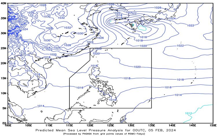
At 4:00 AM on February 5, 2024, the latest weather forecast brings insights into the atmospheric conditions shaping up across the Philippines. The synopsis reveals the influence of easterlies impacting the eastern regions, while the Northeast Monsoon is making its presence felt in Extreme Northern Luzon.

Batanes and Babuyan Islands: Partly cloudy to cloudy skies are anticipated in this area, accompanied by isolated light rains. The Northeast Monsoon is the primary contributor, and fortunately, no significant impacts are expected.
Metro Manila and the rest of the country: For Metro Manila and the rest, expect partly cloudy to cloudy skies with isolated rain showers or thunderstorms. The dynamic interplay of easterlies and localized thunderstorms might lead to possible flash floods or landslides during severe thunderstorms.
Forecast Wind and Coastal Water Conditions:
- Eastern sections of Southern Luzon, Visayas, and Mindanao: Moderate to strong winds from the East to Northeast will prevail, accompanied by moderate to rough seas ranging from 1.2 to 2.8 meters.
- Northern Luzon: Moderate east-to Southeast winds are forecasted, with moderate coastal waters ranging from 1.2 to 2.5 meters.
- The rest of the country: Light to moderate winds from the East to Northeast will be experienced, coupled with slight to moderate seas ranging from 0.6 to 2.5 meters.
Specific Areas:
- Visayas, Palawan, including Kalayaan Islands, and Occidental Mindoro: Partly cloudy to cloudy skies with isolated rain showers or thunderstorms are expected, driven by easterlies and localized thunderstorms. Moderate to strong winds from the East to Northeast will prevail in the eastern section of Visayas, leading to moderate to rough seas. In other parts of Visayas, Palawan, Kalayaan Islands, and Occidental Mindoro, light to moderate winds from the East to Northeast will be accompanied by slight to moderate seas.
- Bicol region, Northern Samar, Oriental Mindoro, Marinduque, and Romblon: Anticipate partly cloudy to cloudy skies with isolated rain showers or thunderstorms. Moderate to strong winds from the East to Northeast will dominate, contributing to moderate to rough seas.
Residents are advised to stay updated on local weather bulletins and take necessary precautions, especially in areas prone to severe weather conditions. Stay safe!
