The Philippine Atmospheric, Geophysical, and Astronomical Services Administration (PAGASA) has forecast that between four and seven tropical cyclones are expected to enter the Philippine Area of Responsibility (PAR) in the final quarter of 2024. This update comes as the country prepares for the annual increase in cyclone activity between October and December.
According to PAGASA’s forecast, the number of tropical cyclones likely to affect the country is distributed as follows:
- October: 2 to 3 tropical cyclones
- November: 1 or 2 tropical cyclones
- December: 1 or 2 tropical cyclones
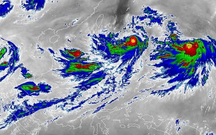
Since the beginning of 2024, nine tropical cyclones have either formed inside or entered PAR. Historically, tropical cyclones during the last three months of the year tend to pass through either Luzon or Visayas. PAGASA weather specialist Joanne Mae Adelino emphasized this in a news conference held in Quezon City, stating that these regions are particularly vulnerable during the closing months of the year.
In addition to the expected tropical cyclones, PAGASA also highlighted the growing likelihood of La Niña developing, which could intensify the severity of storms during this period. There is a 71% probability that La Niña will emerge between September and November and last until the first quarter of 2025.
La Niña Expected to Last Into 2025
PAGASA weather specialists warned that the La Niña phenomenon is expected to intensify tropical cyclones and bring above-average rainfall to the country. La Niña, characterized by the cooling of sea surface temperatures across the central and eastern equatorial Pacific Ocean, typically occurs every two to three years and can last between one and three years.
“La Niña is favored to emerge in September, October, and November 2024, with a 71% chance,” said PAGASA weather specialist Joanne Mae Adelino during the Tuesday press briefing. “We expect it to persist until the first quarter of 2025, covering January, February, and March.”
This projection of La Niña’s development builds upon an earlier alert issued by PAGASA in July when the agency indicated a 70% chance that La Niña could begin between August and October. The successive tropical cyclones in recent months are considered early indicators of La Niña’s impact, which is typically associated with more intense storms and heavier rainfall.
Early Signs of La Niña’s Impact
According to PAGASA Assistant Weather Services Chief Ana Liza Solis, the recent tropical cyclones that have entered PAR could be linked to La Niña’s early effects. In September alone, the country experienced five weather disturbances: Severe Tropical Storm Enteng, Tropical Storm Ferdie, Tropical Depression Gener, Tropical Storm Helen, and Tropical Depression Igme.
While Solis confirmed that the expected La Niña would likely be a weak one, she urged the public not to underestimate its potential effects. “We need to emphasize that, historically, even a weak La Niña can bring more Super Typhoons, especially in September, October, November, and December,” Solis explained. “We have seen in previous instances that weak La Niña conditions can still lead to three or four typhoons reaching Super Typhoon status.”
PAGASA’s Ongoing Monitoring
As the country braces for more tropical cyclones in the months ahead, PAGASA will continue monitoring the weather closely. The agency will provide regular updates to help the public prepare for the heightened risk of severe weather brought on by both the seasonal cyclone activity and the onset of La Niña.
With the possibility of more powerful storms and intense rainfall, PAGASA emphasizes the need for increased vigilance and preparedness during the last quarter of 2024 and into early 2025.