There is growing speculation about the possible return of Severe Tropical Storm (STS) #KristinePH to the Philippine Area of Responsibility (PAR) after it exited the country. According to experts, while storms usually continue their path out of PAR, there is a unique scenario where the storm could loop back due to a phenomenon called the Fujiwhara effect.
The Fujiwhara effect is a rare meteorological phenomenon where two nearby low-pressure systems interact, causing them to rotate or pull each other. In this case, the incoming low-pressure area (LPA) could influence the movement of STS Kristine. If the Fujiwhara effect occurs, Kristine might loop and re-enter PAR.
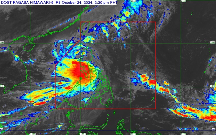
The Philippine Atmospheric, Geophysical, and Astronomical Services Administration (PAGASA) reported that while they are closely monitoring the new LPA, they are also keeping an eye on STS Kristine’s movement. Even though Kristine is currently outside PAR, PAGASA has not ruled out the possibility of its return if it continues to interact with the LPA.
PAGASA weather forecaster Chris Perez explained that while such occurrences are rare, they are not impossible. “There are instances when storms interact, and depending on their strength, they can loop and return to the area they initially left,” Perez said.
The agency also emphasized that they will continue monitoring both weather systems to provide timely updates if necessary. Residents are advised to stay tuned to PAGASA’s official weather bulletins and avoid spreading unverified information.
If STS Kristine does re-enter PAR, it could bring continued rainfall to parts of the country, especially in areas already affected by the southwest monsoon or habagat. Residents in low-lying areas are reminded to prepare for possible flooding and landslides.
As of now, PAGASA remains vigilant in monitoring these weather systems and is expected to release more accurate forecasts in the coming days.