The Philippine Atmospheric, Geophysical and Astronomical Services Administration (PAGASA) has issued a weather forecast for November 28, 2025, highlighting a complex interplay of three distinct weather systems: the Shear Line, the Northeast Monsoon (Amihan), and the trough of the outbound Severe Tropical Storm (STS) Koto. This combination is set to bring considerable rainfall, particularly across Luzon and Palawan, raising the alert for potential flooding and landslides.
Northern Luzon remains the epicenter of the most significant weather activity. The Shear Line, a convergence zone of winds, is zeroing in on the eastern section of Northern Luzon, bringing cloudy skies and scattered rains to areas like Apayao, Kalinga, Mountain Province, Ifugao, Cagayan, Isabela, Quirino, and Nueva Vizcaya. The associated rainfall is expected to be moderate to heavy, leading to a high probability of flash floods and landslides. Specifically, the heavy rainfall outlook for today indicates 50-100 mm of rain over Cagayan, Apayao, and Isabela, with similar conditions forecast for Cagayan and Apayao tomorrow, a clear advisory for residents and local disaster risk reduction and management offices.
Simultaneously, the chilling influence of the Northeast Monsoon prevails over the rest of Northern Luzon, including the Ilocos Region, Batanes, and the rest of the Cordillera Administrative Region. These areas can anticipate cloudy skies with persistent rains, also carrying the threat of flash floods and landslides due to moderate to at times heavy downpours.
STS Koto Trough Still A Threat
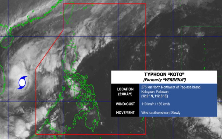
While the former Typhoon “Verbena,” now STS Koto (2527), is situated outside the Philippine Area of Responsibility (PAR) at 275 km north-northwest of Pag-asa Island, Kalayaan, Palawan, its trough continues to affect the western portion of the country. Palawan is specifically forecast to experience cloudy skies with scattered rains and thunderstorms from this system’s extension. The inherent risk remains: possible flash floods or landslides from moderate to, at times, heavy rains across the island.
The general Philippine area, including Metro Manila and the rest of the country, can expect partly cloudy to cloudy skies punctuated by isolated rainshowers or thunderstorms, primarily triggered by Localized Thunderstorms. While less widespread, residents must still be vigilant for potential flash floods or landslides during severe thunderstorm activity. Additionally, the Easterlies will contribute to similar conditions, bringing scattered rains and thunderstorms over Aurora and Quezon.
Coastal Waters Alert
Mariners are strongly advised to exercise caution due to rough sea conditions, especially in the north. Coastal waters in Northern Luzon will be Moderate to Rough (2.5 to 5.0 meters) due to moderate to strong Northeast winds, making sea travel risky for small craft. The western sections of Central and Southern Luzon will also see Moderate to Rough (1.2 to 2.8 meters) conditions.
The weather picture is one of widespread precipitation, driven by a convergence of major systems. With General Flood Advisories already in effect for numerous regions, all concerned are urged to heed the warnings and take necessary precautions to safeguard life and property.