The Philippine Atmospheric, Geophysical and Astronomical Services Administration (PAGASA) issued its latest advisory at 5:00 AM on Wednesday, January 21, 2026, regarding Tropical Depression #AdaPH, internationally named NOKAEN. The bulletin is valid until the next update at 11:00 AM today.
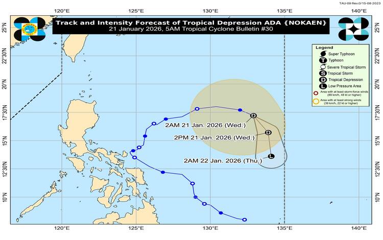
As of 4:00 AM, the center of Tropical Depression ADA was located approximately 1,215 kilometers east of Northern Luzon, near coordinates 17.0°N, 133.1°E. The weather disturbance is now moving east-southeastward at a speed of 20 kilometers per hour while remaining over the sea east of Northern Luzon. ADA continues to maintain maximum sustained winds of 55 km/h near its center, with gustiness reaching up to 70 km/h and a central pressure of 1000 hPa.
Despite its distance from land, Tropical Depression ADA has an extensive wind field, with strong winds extending outward up to 440 kilometers from the center. However, PAGASA clarified that no Tropical Cyclone Wind Signal (TCWS) is currently hoisted over any part of the country, as the system is not expected to directly impact land areas.
Meanwhile, the surge of the Northeast Monsoon, locally known as “Amihan,” is expected to bring significant weather hazards across large portions of the Philippines. From January 21 to 23, strong to gale-force gusts may affect most of Luzon, the Visayas, Caraga, the Davao Region, Northern Mindanao, the Zamboanga Peninsula, and parts of the Bangsamoro region, especially in coastal and upland areas exposed to winds.
PAGASA has also raised a Gale Warning over the eastern seaboards of Luzon and the northern and western seaboards of Northern Luzon. Sea conditions are forecast to be very rough, with waves reaching up to 5.5 meters along the seaboards of Batanes, the Babuyan Islands, Isabela, and mainland Cagayan. Other coastal areas, including parts of Ilocos, Aurora, Bicol Region, Eastern Visayas, and eastern Mindanao, may experience rough to moderate seas.
Authorities strongly advise all mariners to remain in port or seek safe harbor, as sea travel is considered risky for vessels of all sizes in affected areas. Small seacraft operators, in particular, are urged not to venture out to sea.
Looking ahead, PAGASA said ADA is expected to continue moving generally southeastward over the next 24 hours. Due to dry air intrusion associated with the northeast monsoon, the system is likely to weaken further and may be downgraded into a low pressure area later today or by early Thursday morning.