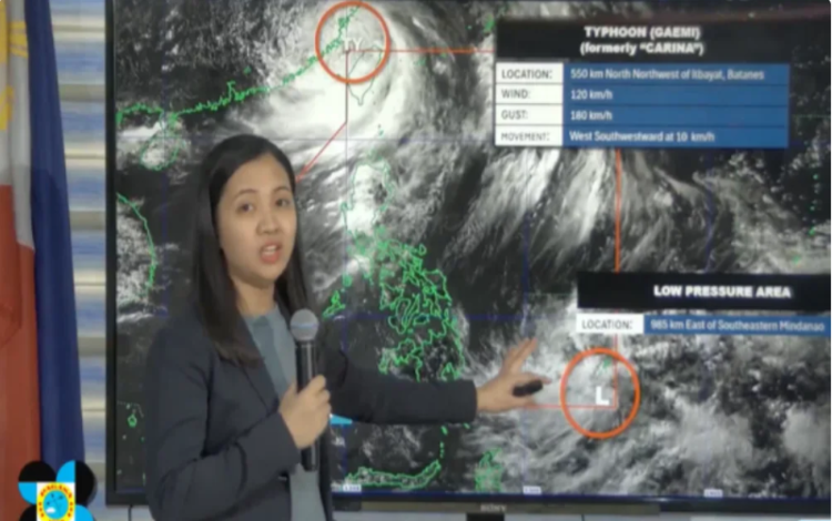
On Thursday, July 25, 2024, a new low-pressure area (LPA) was recorded within the Philippine Area of Responsibility (PAR), according to the Philippine Atmospheric, Geophysical and Astronomical Services Administration (PAGASA). The LPA formed around 2:00 PM and was located 985 kilometers east of Southeastern Mindanao.
Despite the formation of the new LPA, PAGASA emphasized that it remains far from land and currently has no direct impact on any part of the country. The chance of the LPA developing into a typhoon within the next 24 to 48 hours is low.
Meanwhile, Typhoon Carina, now known as Typhoon Gaemi after exiting the PAR, continues to weaken. The latest update from PAGASA indicates that the typhoon is now located in the southeastern portion of China. Typhoon Carina exited the PAR around 6:20 AM on Thursday and has continued to enhance the southwest monsoon or habagat.
The habagat, intensified by the typhoon, is expected to bring heavy rains to several parts of the country on Thursday evening. According to PAGASA, areas likely to be affected include the Ilocos Region, Abra, Apayao, Benguet, Zambales, and Bataan. Residents in these areas are advised to prepare for potential flooding and landslides due to the heavy rainfall.
Signal No. 1 remains in effect for Batanes as a precautionary measure for Typhoon Carina. Local government agencies and communities are urged to stay alert and follow PAGASA’s advisories to ensure everyone’s safety.