Synopsis: As of 3:00 AM today, the center of Tropical Storm “Carina” (Gaemi) was located 490 km east of Casiguran, Aurora (16.6°N, 126.7°E). The storm is moving west-northwestward at 10 km/h, with maximum sustained winds of 75 km/h and gustiness of up to 90 km/h.
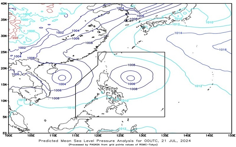
Meanwhile, the tropical depression formerly known as “Butchoy” is now located outside the Philippine Area of Responsibility, 905 km west of Iba, Zambales (16.3ºN, 111.6ºE), with maximum sustained winds of 55 km/h and gustiness of up to 70 km/h, moving westward at 15 km/h.
Forecast Weather Conditions
Affected Areas:
- Antique, Occidental Mindoro, Zambales, Bataan, Pangasinan, La Union, and Northern Palawan including Cuyo, Calamian, and Kalayaan Islands: Cloudy skies with scattered rain showers and thunderstorms are expected due to the southwest monsoon. There is a potential for flash floods or landslides due to moderate to heavy rains.
- Metro Manila, Mindanao, Cavite, Laguna, Batangas, the rest of Visayas, and the rest of MIMAROPA: Partly cloudy to cloudy skies with isolated rain showers or thunderstorms caused by the southwest monsoon. Flash floods or landslides may occur during severe thunderstorms.
- The rest of Luzon: Partly cloudy to cloudy skies with isolated rain showers or thunderstorms due to localized thunderstorms, with possible flash floods or landslides during severe thunderstorms.
Forecast Wind and Coastal Water Conditions
- Western section of Luzon: Winds will be moderate to strong, blowing from the southwest to southeast, with moderate to rough coastal waters (1.5 to 3.5 meters).
- Southern Luzon, Visayas, and Mindanao: Winds will be moderate to strong from the south to southwest, with moderate to rough seas (1.2 to 2.8 meters).
- The rest of Luzon: Light to moderate winds from the northeast to northwest, with slight to moderate coastal waters (0.6 to 2.1 meters).
Heavy Rainfall and Flood Advisories
Heavy Rainfall Warning No. 1:
- It is issued at 5:30 AM for the Kalayaan Islands in Palawan, where flooding is possible in low-lying areas and landslides in mountainous areas. This is based on current radar trends and all available meteorological data.
General Flood Advisories:
- They were issued at 6:00 AM for several regions including CAR, Ilocos Region, Central Luzon, CALABARZON, MIMAROPA, Bicol Region, Western Visayas, Central Visayas, Eastern Visayas, Zamboanga Peninsula, Northern Mindanao, CARAGA, and BARMM. The public and concerned disaster risk reduction and management councils should take appropriate actions.
The public is advised to stay updated with the latest weather information and heed any warnings or advisories from local authorities.