The Philippine Atmospheric, Geophysical and Astronomical Services Administration (PAGASA) issued its latest afternoon weather forecast on Tuesday, October 14, 2025, reporting that two Low Pressure Areas (LPAs) are being closely monitored—one inside and another outside the Philippine Area of Responsibility (PAR).
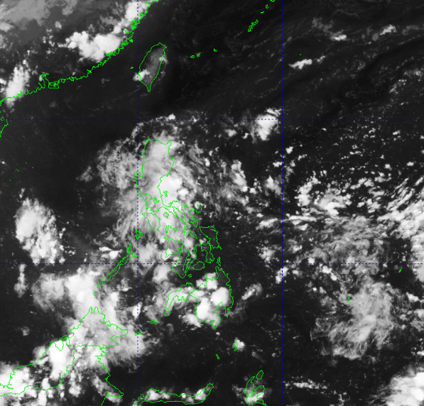
As of 2:00 PM, the first Low Pressure Area (LPA 10e) was located outside the PAR but continues to influence the country’s weather. It was estimated at 130 kilometers east-southeast of Baler, Aurora (15.5°N, 122.8°E). PAGASA noted that this system has a medium chance of developing into a tropical depression within the next 24 hours. Meanwhile, another weather disturbance, identified as LPA 10f, remains inside the PAR but is unlikely to develop into a tropical depression soon.
Due to the combined effects of the two LPAs and the prevailing easterlies, several areas in Luzon and the Visayas are expected to experience cloudy skies, scattered rains, and isolated thunderstorms throughout the day. PAGASA advised residents in affected areas to stay alert for possible flash floods and landslides, especially in regions prone to heavy rainfall.
Metro Manila, CALABARZON, Isabela, Aurora, Pampanga, Nueva Ecija, Bulacan, Bataan, and Camarines Norte will experience cloudy skies with scattered rains and thunderstorms caused by the LPA. PAGASA warned of moderate to occasionally heavy rains in these provinces, which may result in localized flooding or landslides.
Meanwhile, the Visayas, MIMAROPA, and the rest of the Bicol Region will have partly cloudy to cloudy skies with isolated rain showers or thunderstorms due to the easterlies. Severe thunderstorms may bring sudden heavy downpours, so residents are urged to remain cautious, particularly in low-lying areas.
In extreme Northern Luzon, a northeasterly wind flow will bring partly cloudy to cloudy skies with isolated light rains, though PAGASA said no significant impact is expected in the area. Mindanao and the rest of the country will also experience partly cloudy to cloudy conditions with localized thunderstorms in the afternoon or evening, which may lead to flash floods or landslides in susceptible areas.
For wind and coastal water conditions, light to moderate winds blowing from the east to northeast are expected over Luzon and Visayas, with coastal waters ranging from slight to moderate (0.6 to 1.8 meters). In Mindanao, winds will be light to moderate coming from the northeast to east, with similar sea conditions (0.6 to 1.5 meters).
As of 6:00 PM, PAGASA also issued general flood advisories for several regions: GFA #1 for Central Luzon (Region III), GFA #3 for CALABARZON (Region IV-A), and GFA #2 for the Bicol Region (Region V).
PAGASA continues to monitor the movement of the two LPAs and advises the public to stay updated through its official channels for further bulletins and weather advisories. Residents in flood-prone areas are encouraged to take precautionary measures and coordinate with local disaster risk reduction offices.