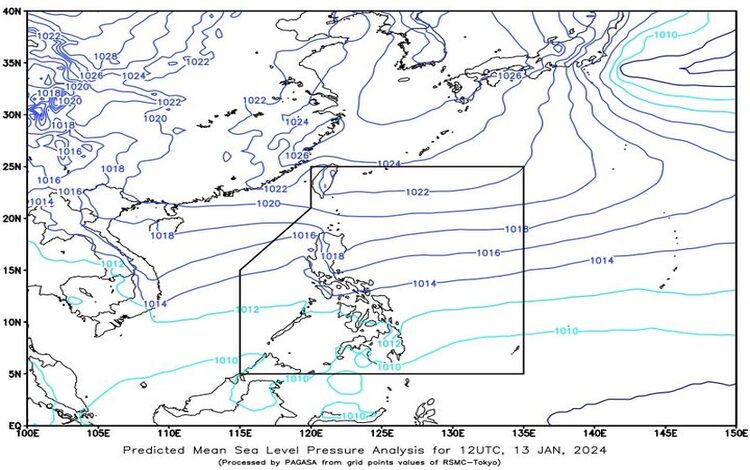
As the nation navigates through the atmospheric intricacies, the latest weather forecast issued at 4:00 PM on 13 January 2024 provides valuable insights into the diverse conditions expected across different regions of the Philippines.

Synopsis
The current weather patterns are influenced by a shear line affecting the eastern section of Visayas and the persistent Northeast Monsoon, impacting Luzon and the remainder of Visayas.
Eastern Visayas, Central Visayas, Caraga, and Northern Mindanao
Weather Condition: Cloudy skies with scattered rain showers and thunderstorms.
Caused By: Shear Line
Impacts: Residents in these areas should remain vigilant as moderate to heavy rains could lead to possible flash floods or landslides.
Mainland Cagayan, Isabela, Aurora, Quezon, Oriental Mindoro, Marinduque, Romblon, Bicol Region, and Western Visayas
Weather Condition: Cloudy skies with light rains.
Caused By: Northeast Monsoon
Impacts: Although light, the continuous rains pose no significant threats to this region.
Metro Manila and the rest of Luzon
Weather Condition: Partly cloudy to cloudy skies with isolated light rains.
Caused By: Northeast Monsoon
Impacts: The general forecast for Luzon indicates no significant impact, allowing residents to go about their daily activities with minimal disruption.
The Rest of Mindanao
Weather Condition: Partly cloudy to cloudy skies with isolated rain showers or thunderstorms.
Caused By: Localized Thunderstorms
Impacts: While conditions may be relatively mild, residents should stay alert for possible flash floods or landslides during severe thunderstorms.

Forecast Wind and Coastal Water Conditions
Eastern Sections of Southern Luzon and Visayas:
- Wind Speed: Strong
- Wind Direction: Northeast
- Coastal Waters: Rough (2.8 to 4.0 meters)
Rest of the Country:
- Wind Speed: Moderate to Strong
- Wind Direction: Northeast
- Coastal Waters: Moderate to Rough (1.2 to 3.7 meters)
