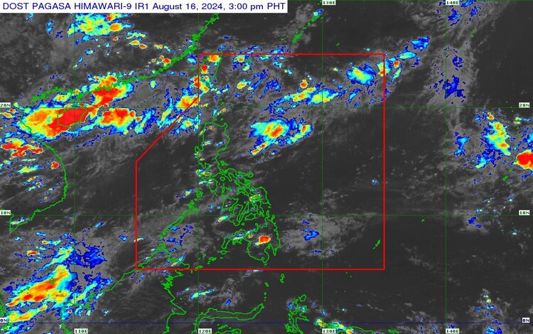
The Philippine Atmospheric, Geophysical, and Astronomical Services Administration (PAGASA) released its afternoon weather forecast for Friday, August 16, 2024. As of 3:00 PM, a low-pressure area (LPA) was detected approximately 290 kilometers north-northeast of Itbayat, Batanes, located at 23.3°N, 122.3°E. The southwest monsoon continues to affect the Extreme Northern Luzon region.
LPA Update and Possible Cyclone Development
According to PAGASA, the LPA developed early Friday morning over the northern part of the Philippine Sea. By Saturday, August 17, it is expected to exit the Philippine area of responsibility (PAR). Upon exiting, the LPA may intensify into a tropical cyclone, although it is currently being closely monitored for further developments.
Weather Forecast for Affected Areas
Batanes and Babuyan Islands:
These areas are expected to experience partly cloudy to cloudy skies, along with isolated rain showers or thunderstorms, primarily due to the southwest monsoon. Residents in these regions are advised to be cautious, as severe thunderstorms may lead to flash floods or landslides, especially in low-lying areas.
Metro Manila and the Rest of the Country:
In Metro Manila and other parts of the country, weather conditions will remain partly cloudy to cloudy with isolated rain showers or thunderstorms. The localized thunderstorms are the primary cause of these rainfalls. Just like in the northern regions, residents are advised to be alert for possible flash floods or landslides during severe thunderstorms.
Wind and Coastal Water Conditions
Throughout the country, wind conditions will be generally light to moderate, coming from the southeast to the southwest. Coastal waters will be slight to moderate, with wave heights ranging between 0.6 to 2.1 meters. These conditions are expected to be manageable for small vessels, although caution is still advised.
While the LPA is not expected to bring significant widespread rainfall, localized thunderstorms could pose risks of flash floods and landslides, particularly in vulnerable areas. The public is encouraged to stay informed about PAGASA’s updates and warnings, especially those living in northern Luzon and coastal areas.
PAGASA will continue to monitor the weather system and provide timely updates to ensure the safety of the public.