The Philippine Atmospheric, Geophysical and Astronomical Services Administration (Pagasa) announced that the tropical depression being monitored outside the Philippine Area of Responsibility (PAR) has strengthened into a tropical storm as of 4 p.m. on Friday. Now officially named “Kong-rey” by the Japan Meteorological Agency (JMA), it was last tracked approximately 2,410 kilometers east of Southeastern Luzon.
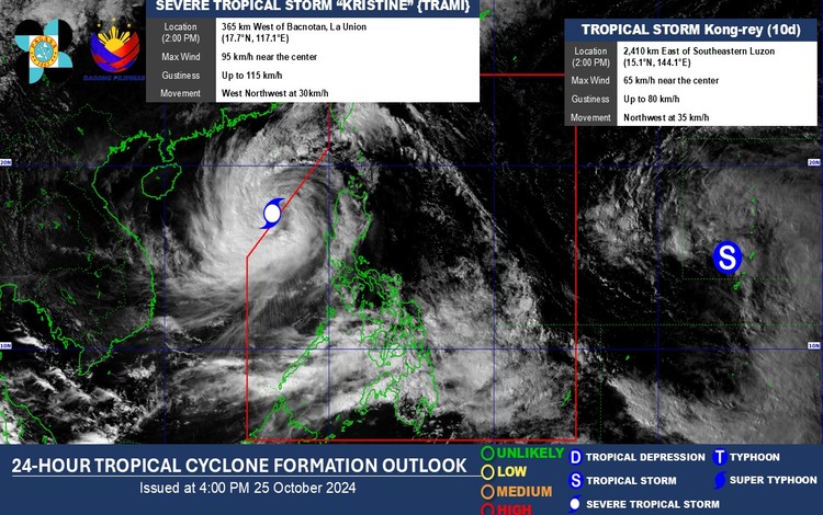
Kong-rey, currently a tropical storm, is projected to move westward and could enter the PAR by Sunday when it would be locally named “Leon.” However, JMA’s initial forecast suggests that the storm may follow a recurving path east of Batanes, sparing the Philippines from any direct landfall.
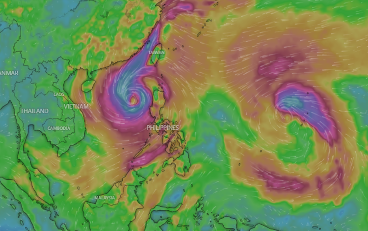
While Kong-rey’s forecasted track indicates it will likely avoid hitting any part of the country, the storm may still influence the weather pattern in the region. Pagasa meteorologists are closely monitoring Kong-rey’s movements, especially as it approaches the boundary of the PAR. They noted that Kong-rey’s presence could interact with Severe Tropical Storm Kristine, currently within the PAR, through a phenomenon known as the Fujiwhara effect.
The Fujiwhara effect occurs when two tropical cyclones near each other interact and potentially affect each other’s movement. In this case, if Kong-rey continues to intensify, it may pull Kristine back towards its path, altering both storms’ trajectories and causing shifts in their predicted courses. This interaction could prolong Kristine’s stay within the PAR and could bring intermittent rains to parts of Northern Luzon over the weekend.
Pagasa has issued an advisory for residents of Northern Luzon, particularly in Batanes and the Babuyan Islands, to stay informed about updates and possible weather advisories in the coming days. Although Tropical Storm Kong-rey is unlikely to bring widespread disruption, its influence on Kristine could cause changes to localized weather conditions, which will be monitored closely.
As of now, both tropical systems pose no immediate threat to the Philippine mainland. However, Pagasa emphasized the importance of remaining vigilant, especially as storm tracks and intensities can change rapidly. The agency will continue to provide updates, particularly on Kong-rey’s entry into PAR and any potential impacts from its interaction with Kristine, to ensure that affected areas can take necessary precautions.
Further updates will be posted by Pagasa as Kong-rey nears PAR’s borders and potentially sets the stage for a unique weather pattern involving two storms within proximity.