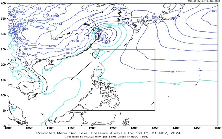
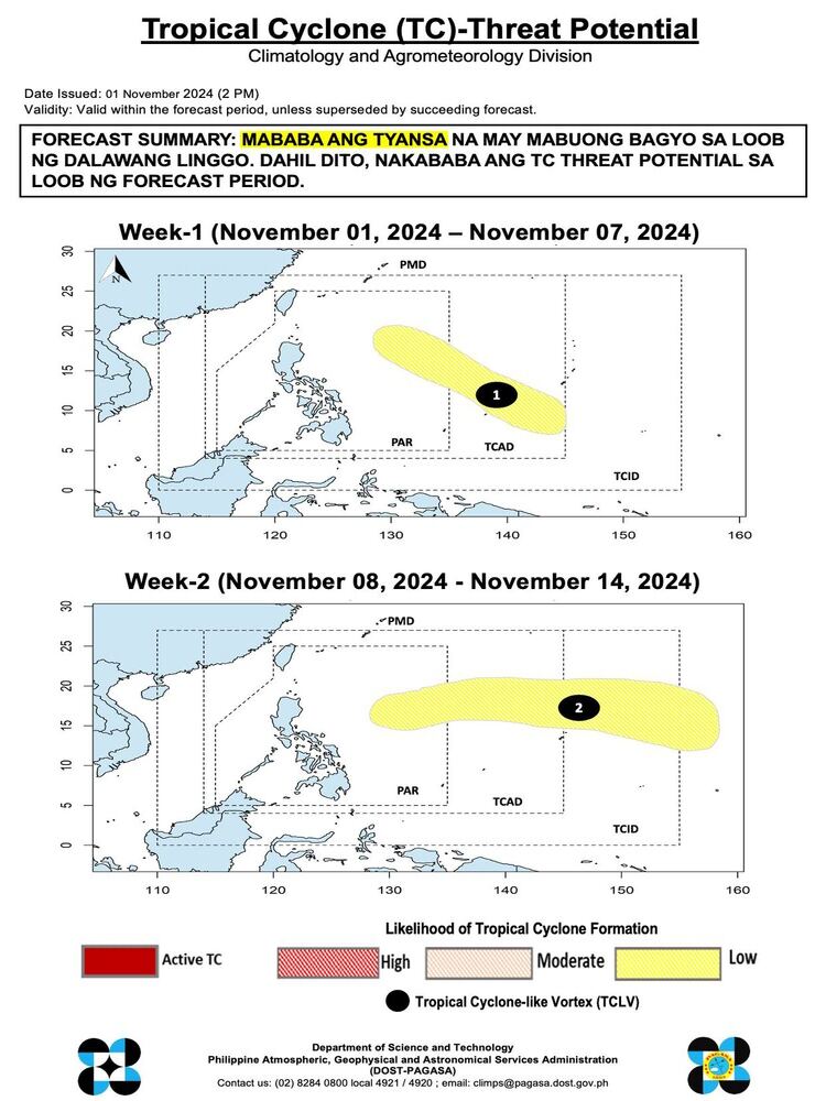
As of the afternoon of November 1, 2024, the Philippine Atmospheric, Geophysical and Astronomical Services Administration (Pagasa) has released the latest weather update, focusing on the potential development of tropical cyclones, current weather conditions, and marine advisories across the country. Here’s the detailed forecast for the day.

Tropical Cyclone Threat Potential
Forecast Summary:
Pagasa’s Tropical Cyclone (TC) forecast indicates a low likelihood of cyclone formation within the next two weeks. This means that, as of this forecast period, no significant weather disturbances or cyclones are expected to develop that could intensify into a typhoons.

General Weather Synopsis
Current Weather System Influences:
The easterlies, or warm winds coming from the Pacific Ocean, continue to affect the eastern sections of Luzon and the Visayas. These easterlies bring warm and moist air, which is causing partly cloudy to cloudy conditions with chances of rain and localized thunderstorms across the affected areas.
Forecasted Weather Conditions by Region
Palawan (Including Kalayaan Islands)
- Weather Condition: Cloudy skies with scattered rain showers and thunderstorms.
- Cause: Trough of Tropical Storm (TS) Kong-Rey.
- Potential Impacts: Moderate to heavy rainfall from thunderstorms could lead to flash floods and landslides, especially in low-lying and mountainous areas. Residents are advised to remain alert and take necessary precautions.
Cagayan Valley, Aurora, Quezon, Bicol Region, and Eastern Visayas
- Weather Condition: Partly cloudy to cloudy skies with isolated rain showers or thunderstorms.
- Cause: Influences from the easterlies.
- Potential Impacts: Although rainfall is expected to be isolated, thunderstorms could cause severe downpours in certain areas, potentially leading to flash floods and landslides.
Metro Manila and the Rest of the Philippines
- Weather Condition: Partly cloudy to cloudy skies with isolated rain showers or thunderstorms.
- Cause: Localized thunderstorms.
- Potential Impacts: Isolated rainfall may lead to flash floods in vulnerable areas during severe thunderstorms. Residents in flood-prone regions should monitor for sudden weather changes.
Wind and Coastal Water Conditions
Extreme Northern Luzon and Western Sections of Luzon
- Wind Speed and Direction: Moderate to rough winds, blowing from the southwest to south.
- Coastal Water Conditions: Seas are expected to be moderate to rough, with wave heights ranging from 2.5 to 3.1 meters.
- Advisory: Small sea vessels are advised to exercise caution in navigating through rough seas in these areas, as moderate to strong winds may pose safety risks.
Visayas and Rest of Luzon
- Wind Speed and Direction: Light to moderate winds from the east.
- Coastal Water Conditions: Waters will be slight to moderate, with waves from 0.6 to 2.1 meters.
- Advisory: Favorable sea conditions are expected, but small boats should remain cautious as occasional gusts may affect navigation.
Mindanao
- Wind Speed and Direction: Light to moderate winds from the east to northeast.
- Coastal Water Conditions: Seas will remain slight to moderate, with wave heights ranging from 0.6 to 2.1 meters.
- Advisory: Relatively calm seas, but maritime operators are advised to stay updated on any changes in conditions.
Additional Advisory
Due to the influence of the easterlies, rain showers and thunderstorms could develop swiftly, particularly in the eastern sections of Luzon and Visayas. The Trough of TS Kong-Rey, which primarily impacts Palawan and the Kalayaan Islands, may bring heavier rainfall and thunderstorms in those areas, necessitating vigilance for flash floods and landslide-prone zones.
