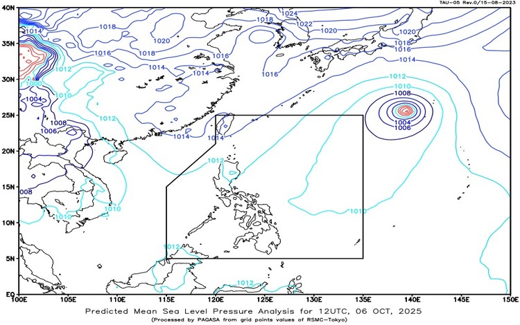
The Philippine Atmospheric, Geophysical and Astronomical Services Administration (Pagasa) released its latest weather bulletin on Monday, October 6, 2025, highlighting the continued influence of the Intertropical Convergence Zone (ITCZ) over Visayas and Mindanao. Meanwhile, Typhoon Halong, still outside the Philippine Area of Responsibility (PAR), was located 2,005 kilometers east northeast of extreme Northern Luzon as of 3:00 PM. It is packing maximum sustained winds of 120 kilometers per hour near the center, with gustiness reaching up to 150 km/h, moving west-northwestward at 10 km/h. Though far from the country, Pagasa continues to monitor its track.
Weather Conditions Across the Country
In Quezon and Aurora, cloudy skies with scattered rains and thunderstorms are expected due to the prevailing northeasterly windflow. Moderate to at times heavy rains could trigger flash floods and landslides.
Western Visayas, the Negros Island Region, Central Visayas, Zamboanga Peninsula, Northern Mindanao, and Palawan will also experience cloudy skies with scattered rains and thunderstorms brought about by the ITCZ. These areas are warned of potential flooding and landslides.
The rest of Visayas and Mindanao will have partly cloudy to cloudy skies with isolated rainshowers or thunderstorms, also due to the ITCZ. Severe thunderstorms may result in sudden flooding or landslides.
In Northern Luzon, particularly Cagayan Valley, Ilocos Norte, and Apayao, partly cloudy to cloudy skies with isolated rainshowers are forecast due to the northeasterly windflow. Metro Manila and the remainder of Luzon are expected to experience generally fair weather with partly cloudy to cloudy skies, although localized thunderstorms remain possible.
Wind and Coastal Conditions
The northern and eastern sections of Luzon will experience light to moderate winds from the northeast, with coastal waters slightly to moderately (0.6 to 1.8 meters). In the southern portion of Mindanao, winds will be light to moderate from the southwest, bringing slight to moderate seas. The rest of the country will experience light to moderate winds from northwest to northeast, with calmer seas ranging from 0.6 to 1.2 meters.
Temperature and Humidity
For the 24 hours ending 4:00 PM, Pagasa recorded a minimum temperature of 24.5°C at 6:30 AM and a maximum of 32.4°C at 12:00 PM. Relative humidity ranged from a low of 57% at noon to a high of 94% at 7:00 AM.
Flood Advisory
A general flood advisory (GFA #2) remains in effect for Region XI (Davao Region), Region XII (SOCCSKSARGEN), and the Bangsamoro Autonomous Region in Muslim Mindanao (BARMM), urging residents in flood-prone areas to take precautions.
Pagasa advises the public to remain vigilant, particularly in regions under ITCZ influence, and to monitor official updates for localized warnings.