The Philippine Atmospheric, Geophysical and Astronomical Services Administration (PAGASA) issued a comprehensive weather forecast for Saturday, November 29, 2025, warning the public of a complex weather scenario affecting large parts of the country. A formidable combination of the Shear Line, the Northeast Monsoon (Amihan), and the Trough of Severe Tropical Storm (STS) Koto (formerly “Verbena”) is set to bring considerable rainfall, raising the specter of flash floods and landslides across Luzon and Palawan.
Northern Luzon on High Alert
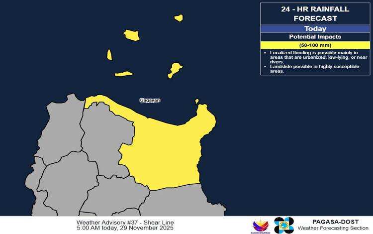
The Shear Line, a convergence of winds, is directly impacting the eastern section of Northern Luzon. Residents in Apayao, Kalinga, Cagayan, and Isabela should prepare for cloudy skies accompanied by scattered rains and isolated thunderstorms. The potential for flash floods or landslides due to moderate to heavy rains is significant, particularly in mountainous and low-lying areas. An active General Flood Advisory (GFA #5 for CAR, GFA #20 for Cagayan Valley) is in effect for these regions, underscoring the severity of the expected deluge.
Meanwhile, the familiar chill of the Northeast Monsoon (Amihan) grips the Ilocos Region, Batanes, and the rest of the Cordillera Administrative Region. This system is bringing cloudy skies and continuous rains, which may also be moderate to at times heavy, posing a risk of flash floods and landslides.
STS Koto’s Distant Influence
Though outside the Philippine Area of Responsibility (PAR), Severe Tropical Storm Koto (2527) is still making its presence felt. Located 345 km northwest of Pag-asa Island, Kalayaan, Palawan, and moving northward, its trough is responsible for the cloudy skies with scattered rains and thunderstorms over Palawan. The province should anticipate moderate to at times heavy rains, which can trigger flash floods and landslides.
Fairer Skies but Caution Still Advised
The rest of the country, including Metro Manila and the remaining parts of Luzon, Visayas, and Mindanao, will experience partly cloudy to cloudy skies with isolated rainshowers or thunderstorms. These conditions are primarily due to the Easterlies and Localized Thunderstorms. While generally milder, residents must remain vigilant, as severe thunderstorms can still cause flash floods and landslides.
Coastal waters across Northern Luzon and Palawan will be Moderate to Rough (2.1 to 3.7 meters), making sea travel hazardous for small vessels. The rest of the country can expect Slight to Moderate conditions. The public and disaster risk reduction and management offices are strongly advised to take all necessary measures to protect life and property and monitor for specific Heavy Rainfall Warnings, which are more precise than the current, broader Weather Advisory.