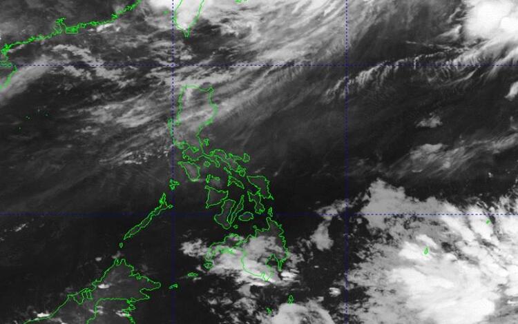
As the clock strikes 5:00 AM on February 14, 2024, the weather forecast unveils a mixed bag of atmospheric conditions across various regions. The Northeast Monsoon asserts its influence over Northern and Central Luzon, while other areas experience localized phenomena.

Eastern Samar: Residents of Eastern Samar can expect cloudy skies punctuated by scattered rain showers and thunderstorms. These weather patterns are attributed to the Shear Line and Easterlies, which converge to create conditions conducive to precipitation.
Visayas, Palawan, Kalayaan Islands, and Occidental Mindoro: In contrast, the rest of Visayas, Palawan (including Kalayaan Islands), and Occidental Mindoro will witness a blend of partly cloudy to cloudy skies. However, this respite from clear skies may come with a price, as these regions are also likely to encounter rain showers and thunderstorms. The primary drivers behind these weather events are the Easterlies and localized thunderstorms.
Wind and Sea Conditions: Moderate to strong winds originating from the East Northeast are anticipated over the Visayas, Palawan (including Kalayaan Islands), and Occidental Mindoro. These winds could stir up moderate to rough seas, urging caution among maritime interests and coastal communities.
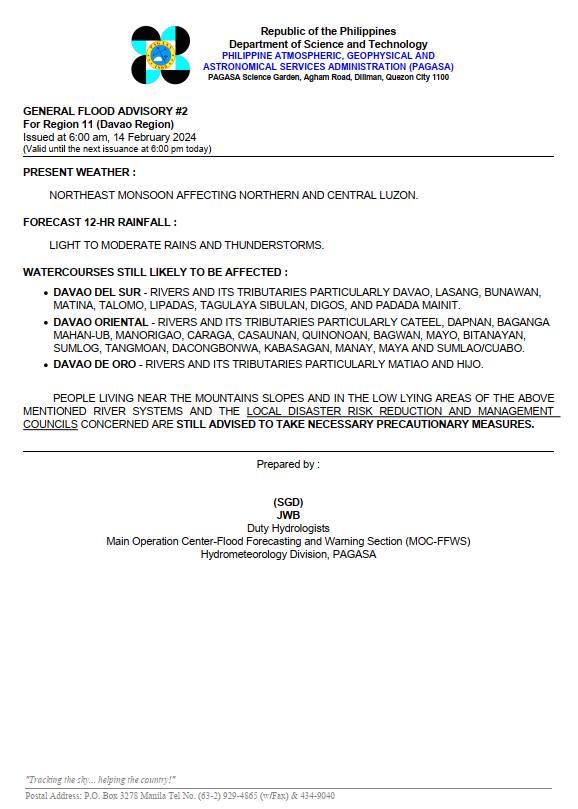
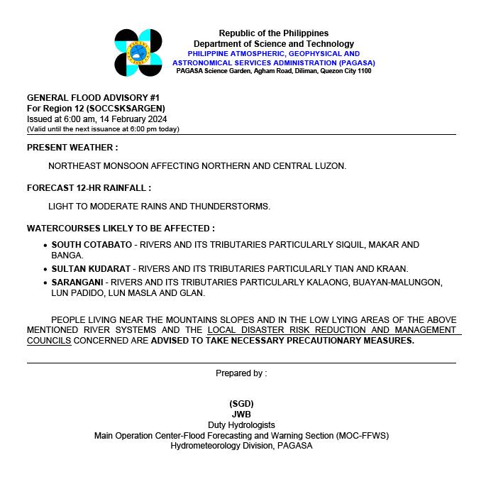
General Flood Advisories: Furthermore, specific regions have been issued General Flood Advisories, indicating potential flood risks. As of 6:00 AM on February 14, 2024, Region 11 (Davao Region) and Region 12 (SOCCSKSARGEN) have been flagged with advisories (GFA#2 and GFA#1 respectively). Residents in these areas are advised to stay vigilant and prepared for possible flood-related situations.


The weather forecast for February 14, 2024, paints a dynamic picture of atmospheric activity. While the Northeast Monsoon exerts its influence over certain regions, others contend with the capricious nature of localized thunderstorms and Easterlies. Vigilance and preparedness remain key as communities navigate these diverse weather conditions. Stay informed, stay safe.
