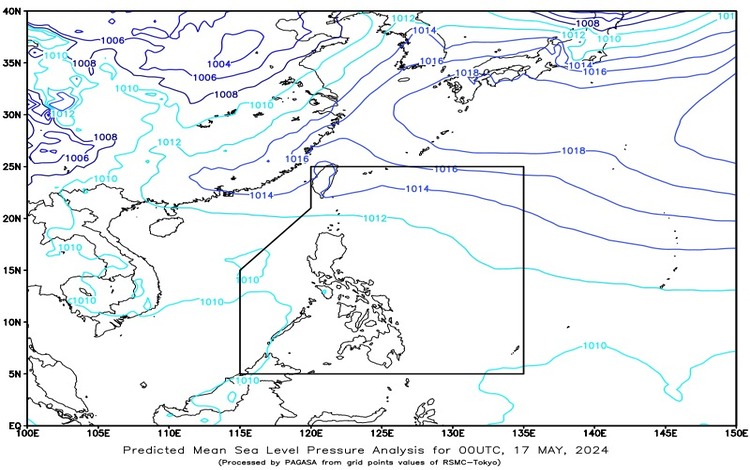
Synopsis: A shear line is currently affecting Extreme Northern Luzon, while easterlies are influencing the weather across the rest of the Philippines.

Forecast Weather Conditions
Batanes, Cagayan, and Isabela:
- Weather Condition: Expect cloudy skies accompanied by scattered rain showers and thunderstorms.
- Cause: This weather pattern is due to the shear line.
- Impacts: Residents should be vigilant for possible flash floods or landslides, especially in areas prone to such hazards, as the rains may be moderate to heavy at times.
Metro Manila and the Rest of the Country:
- Weather Condition: Partly cloudy to cloudy skies with isolated rain showers or thunderstorms.
- Cause: These conditions are influenced by the easterlies.
- Impacts: Although the rain showers are generally isolated, severe thunderstorms could lead to flash floods or landslides in susceptible areas.
Forecast Wind and Coastal Water Conditions
Northern and Western Sections of Northern Luzon:
- Wind Speed: Winds will be moderate to strong.
- Wind Direction: The prevailing wind direction is from the northeast.
- Coastal Waters: Expect moderate to rough conditions with waves reaching heights between 1.2 to 2.8 meters.
Rest of the Country:
- Wind Speed: Winds will be light to moderate.
- Wind Direction: Winds will come from the east to northeast.
- Coastal Waters: Coastal waters will be slight to moderate with wave heights ranging from 0.6 to 2.1 meters.
Extremes of Temperature and Relative Humidity
Over the past 24 hours, the temperature and humidity levels varied significantly:
- Minimum Temperature: 25.8°C at 4:40 AM
- Maximum Temperature: 35.6°C at 2:00 PM
- Minimum Relative Humidity: 44% at 3:00 PM
- Maximum Relative Humidity: 93% at 5:00 AM
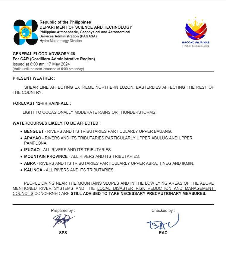
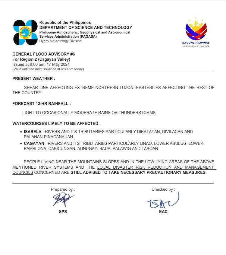
General Flood Advisories
Issued at 6 AM on May 17, 2024:
- CAR (Cordillera Administrative Region): Flood advisory GFA#6 remains in effect.
- Region 2 (Cagayan Valley): Flood advisory GFA#6 is also in place.


Residents in these regions are advised to stay alert and follow any guidance from local authorities to ensure safety, particularly in areas prone to flooding.
For continuous updates and more detailed information, stay tuned to local weather stations and official meteorological advisories.
