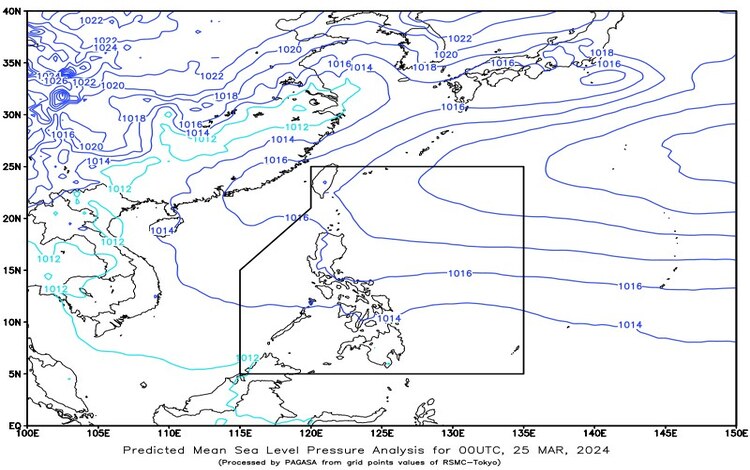
Today March 25, 2024, the weather outlook indicates the influence of easterlies across the eastern sections of the Philippines. Here’s what you need to know:

Eastern Visayas and Caraga: Expect cloudy skies accompanied by scattered rainshowers and thunderstorms in Eastern Visayas and Caraga regions. These weather conditions are attributed to the easterly winds. Residents should remain vigilant as moderate to heavy rainfall may trigger flash floods or landslides in vulnerable areas.
Metro Manila and the Rest of the Country: In Metro Manila and other parts of the Philippines, anticipate partly cloudy to cloudy skies with isolated rainshowers or thunderstorms. These conditions are also influenced by easterlies, coupled with localized thunderstorms. While widespread heavy rainfall is not expected, isolated severe thunderstorms could lead to flash floods or landslides in specific areas.
Wind and Coastal Water Conditions:
- Northern and Eastern Sections: Moderate to strong winds blowing from the east to southeast direction are expected. Coastal waters in these areas will range from moderate to rough, with wave heights between 2.5 to 2.8 meters.
- Rest of the Country: Light to moderate winds coming from the east to northeast direction will prevail. Coastal waters will generally be slight to moderate, with wave heights ranging from 0.6 to 2.1 meters.
Forecast Summary:
- Eastern Visayas: Cloudy skies with scattered rain showers and thunderstorms.
- Caraga: Similar conditions as Eastern Visayas.
- Rest of Visayas, Palawan, including Kalayaan Islands, and Occidental Mindoro: Partly cloudy to cloudy skies with isolated rain showers or thunderstorms.
- Wind and Coastal Conditions: Moderate to strong winds and rough seas in the northern and eastern sections, while the rest of the country will experience light to moderate winds and slight to moderate seas.
