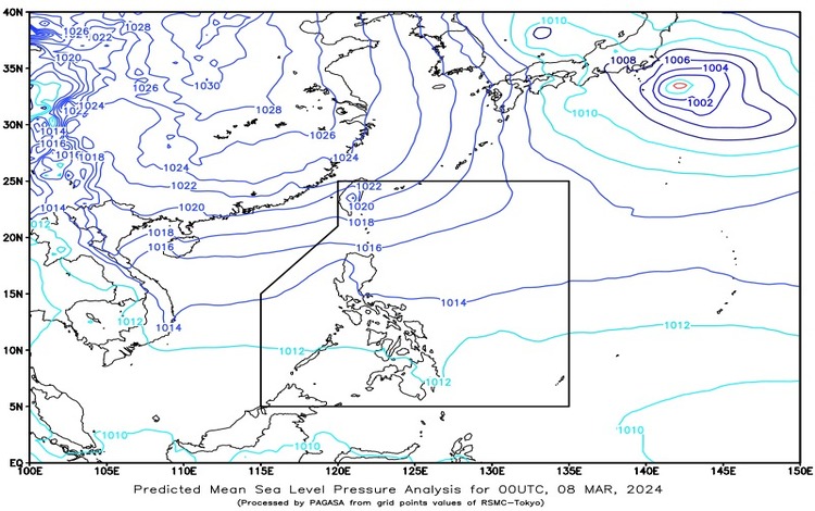
As the nation awakens to a new day, it’s essential to stay informed about the prevailing weather conditions. Here’s your comprehensive weather forecast for March 8, 2024.

Synopsis: The weather dynamics across the Philippines continue to be influenced by two prevailing systems: the Northeast Monsoon affecting Northern Luzon and the Easterlies affecting the rest of the country. Let’s delve into the forecasted conditions for different regions:
Batanes and Cagayan:
- Weather Condition: Expect cloudy skies with light rains, attributed to the Northeast Monsoon.
- Impact: These conditions are not anticipated to cause significant disruptions.
Ilocos Region, Cordillera Administrative Region, and the rest of Cagayan Valley:
- Weather Condition: Partly cloudy to cloudy skies with isolated light rains, also due to the Northeast Monsoon.
- Impact: No major impacts are expected from these weather patterns.
Metro Manila and the rest of the country:
- Weather Condition: Partly cloudy to cloudy skies with isolated rain showers or thunderstorms, influenced by Easterlies and localized thunderstorms.
- Impact: There’s a possibility of flash floods or landslides during severe thunderstorms, so caution is advised.
Wind and Coastal Water Conditions:
- Northern Luzon: Moderate to strong winds blowing from the northeast direction, leading to moderate to rough coastal waters.
- Rest of the country: Expect light to moderate winds also from the northeast, resulting in slight to moderate coastal waters.

Tides and Astronomical Information Over Metro Manila:
- Low Tide Today: Occurred at 04:01 AM, with a value of -0.36 meters.
- High Tide Today: Anticipated at 08:02 PM, with a value of 1.21 meters.
- Sunrise: Look for the sun to rise at 6:08 AM.
- Sunset: The day will conclude with sunset at 6:05 PM.
As you plan your day, keep these weather insights in mind. Stay informed, stay prepared, and stay safe amidst the ever-changing weather patterns. Remember to stay updated with any further advisories from local authorities.
