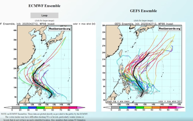
Meteorologist Robert Speta has indicated a heightened possibility of the first named storm of 2025 forming in the Philippine Area of Responsibility (PAR). This potential storm is associated with a low-pressure area (LPA) currently located east of Mindanao. Speta notes that the LPA has a significant chance of intensifying into a tropical depression within the next 24 to 48 hours.
The LPA is situated approximately 360 kilometers east-southeast of Tagum City, Davao del Norte. It is embedded within the Intertropical Convergence Zone (ITCZ), a region where the trade winds from the Northern and Southern Hemispheres meet, often leading to the development of weather disturbances. This positioning suggests that the LPA could bring moderate to heavy rains, particularly to the Caraga region, including Dinagat Islands, Surigao del Norte, Surigao del Sur, and Davao Oriental. Residents in these areas should remain vigilant for potential localized flooding and landslides, especially in low-lying and mountainous regions.
While the LPA is currently moving westward, there is a possibility that it may curve northward and intensify as it approaches the northern Pacific Ocean. If this occurs, the system could become the first named storm of the season. The Philippine Atmospheric, Geophysical and Astronomical Services Administration (PAGASA) has not yet assigned a local name to the system, but it is monitoring its development closely.
PAGASA’s forecast for April 2025 indicates a low likelihood of tropical cyclone formation, with zero to one storm expected to enter or develop within the PAR during the month. However, the presence of the LPA suggests that the onset of the typhoon season may be earlier than anticipated. The agency has also projected that between 16 to 19 tropical cyclones may affect the country in 2025, which is considered below average compared to previous years.
As the situation develops, it is crucial for residents in the affected regions to stay informed through official PAGASA updates and to prepare for potential adverse weather conditions. Continued monitoring of the LPA’s progression will determine its potential to intensify into a named storm and its subsequent impact on the Philippines.