The Philippine Atmospheric, Geophysical and Astronomical Services Administration (PAGASA) issued its 3:00 PM weather bulletin on Monday, June 23, 2025, highlighting the effects of a Low Pressure Area (LPA) and the Southwest Monsoon, or “Habagat,” which are currently influencing weather conditions across much of the country.
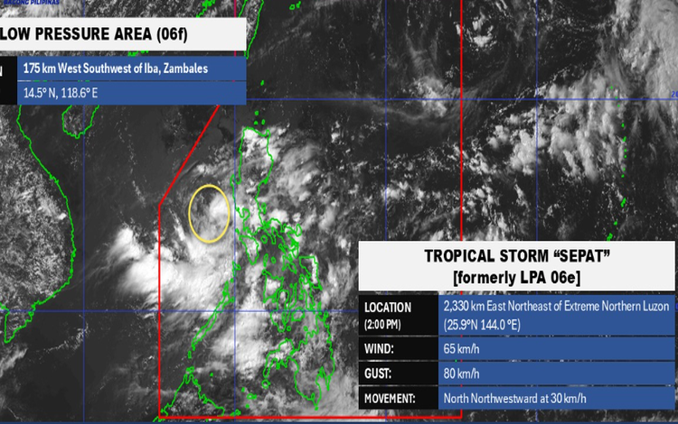
As of 3:00 PM, the LPA was located approximately 185 kilometers west of Cubi Point, Subic Bay International Airport (14.5°N, 118.6°E). Although still outside the Philippine Area of Responsibility (PAR), Tropical Storm SEPAT (international codename 2407) was also monitored at 2,315 kilometers east-northeast of Extreme Northern Luzon. It has maximum sustained winds of 65 kilometers per hour and gusts of up to 80 kilometers per hour, moving north-northwestward at 30 kilometers per hour.
The LPA is directly affecting the provinces of Pangasinan, Zambales, and Bataan, bringing cloudy skies with scattered rain showers and thunderstorms. Residents in these areas are advised to remain alert for possible flash floods or landslides due to moderate to heavy rainfall.
Meanwhile, the Southwest Monsoon continues to affect Southern Luzon, Visayas, Mindanao, and the rest of Central Luzon. Areas such as Metro Manila, CALABARZON, the Bicol Region, MIMAROPA, Western Visayas, Zamboanga Peninsula, BARMM, Negros Occidental, and nearby provinces can expect cloudy skies with scattered rains and thunderstorms, which may also trigger flash floods or landslides.
The rest of Luzon will experience partly cloudy to cloudy skies with isolated rain showers or thunderstorms caused by localized weather disturbances. Similar conditions are expected across the rest of the country, also due to the Southwest Monsoon. These thunderstorms may become severe, posing flood or landslide risks in vulnerable areas.
Wind conditions across Northern and Central Luzon, as well as the western section of Southern Luzon, will be light to moderate, blowing from the southwest to southeast. Coastal waters in these areas will be slight to moderate, with wave heights ranging from 0.6 to 1.8 meters.
In Visayas and the rest of Luzon, winds will come from the southwest to south at light to moderate speeds, with similarly calm seas. Mindanao will also experience light to moderate southwesterly to westerly winds with slight to moderate coastal conditions.
PAGASA continues to monitor the weather systems and advises the public to remain cautious and stay updated through official bulletins.