The Philippine Atmospheric, Geophysical and Astronomical Services Administration (PAGASA) reported that Severe Tropical Storm Uwan (international name: Fung-Wong) has maintained its strength while slowly tracking north-northeastward over the seas south of Taiwan early Wednesday, November 12, 2025.
As of 4:00 a.m., the storm’s center was estimated at 280 kilometers west of Itbayat, Batanes, outside the Philippine Area of Responsibility (PAR). Uwan packs maximum sustained winds of 95 kilometers per hour (km/h) near its center and gustiness reaching 115 km/h, with a central pressure of 990 hPa. The system is moving north-northeast at 10 km/h, with strong to storm-force winds extending outward up to 350 kilometers from the center.
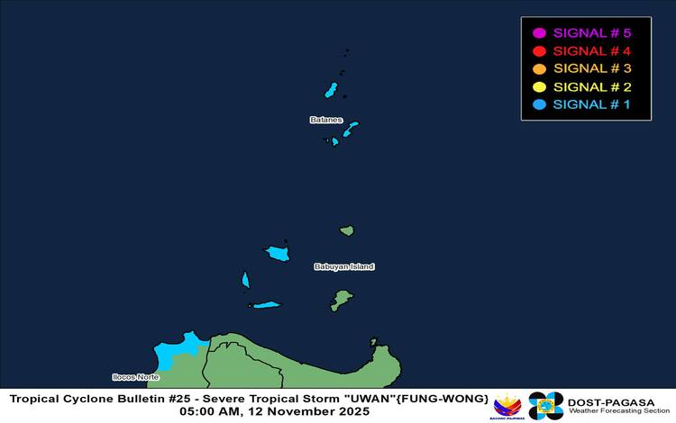
Tropical Cyclone Wind Signals
PAGASA placed Batanes, the Babuyan Islands, and the northwestern portion of Ilocos Norte under Tropical Cyclone Wind Signal No. 1, indicating strong winds within the next 36 hours. Affected areas may experience minimal to minor threats to life and property.
Residents in coastal and upland areas are advised to prepare for gusty winds and possible disruptions due to wind-enhanced conditions. Meanwhile, gusty conditions may also prevail today over the Ilocos Region, Cordillera Administrative Region, Cagayan (including Babuyan Islands), and Isabela, extending to Batanes and Babuyan Islands tomorrow.
Gale Warning and Sea Conditions
A Gale Warning (No. 14) remains in effect over the northern and western seaboards of Northern Luzon. Seas are expected to be very rough, reaching up to 5.0 meters along the coasts of Batanes and 4.5 meters in Babuyan Islands and Ilocos Norte. PAGASA warned that sea travel remains risky, urging all vessels—especially small boats and motorbancas—to stay in port or seek safe harbor.
Moderate to rough sea conditions are also anticipated across Occidental Mindoro, Palawan, Aurora, and Catanduanes, with wave heights ranging between 2.0 to 3.5 meters. Mariners are strongly advised to take caution.
Track and Outlook
According to PAGASA, Uwan is expected to re-enter the PAR this morning or afternoon before making landfall in southwestern Taiwan later today. The storm will likely weaken into a tropical storm before landfall and continue to weaken into a remnant low by Friday due to land interaction and unfavorable environmental factors.
Residents in Northern Luzon are urged to remain vigilant and monitor official forecasts and advisories.