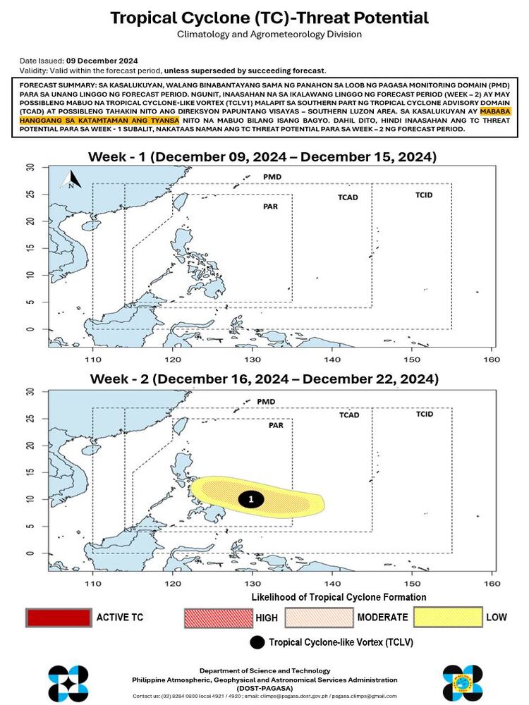
The Philippine Atmospheric, Geophysical and Astronomical Services Administration (PAGASA) released its Tropical Cyclone (TC) Threat Potential Forecast, valid as of December 9, 2024. The forecast provides an overview of expected weather developments within the monitoring domain over the next two weeks.

Current Status
As of now, there are no weather disturbances being monitored within PAGASA’s Monitoring Domain (PMD) for the first week of the forecast period. This indicates stable weather conditions and the absence of imminent tropical cyclone threats.
Week 2 Outlook
However, PAGASA has flagged the potential formation of a tropical cyclone-like vortex (TCLV1) near the southern part of the Tropical Cyclone Advisory Domain (TCAD) during the second week of the forecast period. This system, if it develops further, is projected to move toward the Visayas-Southern Luzon area.
Currently, the likelihood of this system intensifying into a tropical cyclone remains low to moderate. While no immediate threats are anticipated, the agency emphasizes heightened vigilance for the potential threat during Week 2.
Advisory and Precaution
Given these projections, there is no expected tropical cyclone threat for the first week. However, the potential threat level for the second week is elevated, necessitating close monitoring. PAGASA will provide updates as conditions evolve, ensuring that the public remains informed of any changes in the forecast.
The agency also encourages the public to visit its official website to access the Rainfall Exceedance Probability Forecast, which highlights areas in the country that may experience heavy rainfall within the next two weeks. This product is essential for local governments and residents in preparing for possible weather disturbances.
PAGASA assures the public that they will continuously monitor weather developments and issue timely updates as needed. Stay tuned for advisories and maintain preparedness, especially for regions identified as potentially affected in future forecasts.
