June 7, 2025 – The Philippine Atmospheric, Geophysical and Astronomical Services Administration (PAGASA) reported that as of 3:00 PM today, a Low Pressure Area (LPA) was spotted 175 kilometers east of Virac, Catanduanes (13.5°N, 125.8°E). This system, coupled with the strengthening Southwest Monsoon (Habagat), is currently influencing weather patterns across many regions of the country.
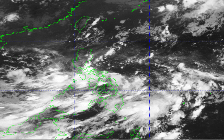
According to the latest advisory issued at 5:00 PM, the LPA is generating cloudy skies with scattered rain showers and thunderstorms over the Bicol Region, Eastern and Central Visayas, as well as the provinces of Aurora and Quezon. These areas are at risk for flash floods and landslides due to moderate to heavy rainfall.
Meanwhile, the Habagat continues to impact a broader swath of the country. Metro Manila, MIMAROPA, Mindanao, the rest of Central Luzon, and the Visayas, as well as the CALABARZON provinces of Cavite, Laguna, Batangas, and Rizal, are experiencing similar weather conditions. Residents are also cautioned against potential flash floods and landslides.
The rest of Luzon will have partly cloudy to cloudy skies with isolated rain showers or thunderstorms, mostly due to localized convection and the monsoon winds. PAGASA warns that even isolated thunderstorms can be intense enough to trigger flash floods in vulnerable communities.
Wind conditions remain light to moderate across all regions, with slight to moderate coastal waters ranging from 0.6 to 1.8 meters. The northern section of Luzon is experiencing easterly to southeasterly winds, while the eastern portions of Central and Southern Luzon have variable winds from the northeast to northwest. The rest of the country is under the influence of the southwest-to-west wind flow.
In terms of temperature, the highest recorded was 29.4°C at 2:00 PM, while the minimum dipped to 24.6°C at 6:00 AM. Relative humidity peaked at 95% early this morning and settled to a low of 76% by mid-afternoon.
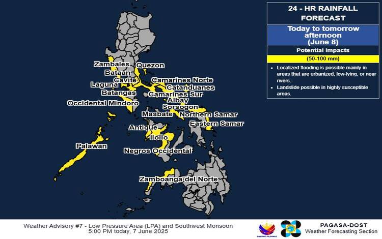
Heavy Rainfall Outlook:
Over the next three days, rainfall totals between 50 and 200 mm are expected across multiple regions, depending on proximity to the LPA and exposure to the monsoon:
- June 7–8: Expect 50–100 mm over Quezon, Bicol provinces, Eastern Samar, Northern Samar, and parts of Western Visayas and Zamboanga Peninsula.
- June 8–9: Palawan, Occidental Mindoro, and Antique may receive up to 200 mm.
- June 9–10: Heavy rains of up to 200 mm are forecasted again for Palawan, Occidental Mindoro, and Antique.
Rainfall may intensify in elevated or mountainous regions, and prior saturation from earlier downpours could worsen flooding and landslide risks.
PAGASA continues to urge local disaster officials and residents in affected areas to take all necessary precautions. Heavy Rainfall Warnings and localized Thunderstorm Advisories may be issued by regional offices when necessary. The next official update is scheduled for release at 11:00 PM tonight.