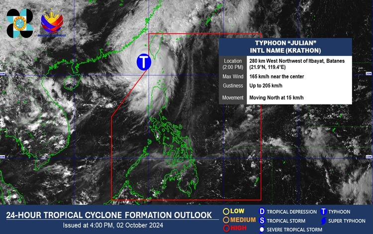
Typhoon “Julian” (international name: Krathon) continues to affect Northern Luzon, with significant weather disturbances expected in the coming hours. The Philippine Atmospheric, Geophysical, and Astronomical Services Administration (Pagasa) reports that Typhoon Julian, located 270 kilometers west-northwest of extreme Northern Luzon (21.9°N, 119.5°E), is moving northward at 15 kilometers per hour (km/h). It currently packs maximum sustained winds of 165 km/h near the center, with gustiness reaching up to 205 km/h.
Affected Areas and Forecast Conditions:
Batanes and Babuyan Islands are under the influence of Typhoon Julian, where rain with gusty winds is expected. The strong winds and heavy rains may lead to flash floods or landslides, especially in areas vulnerable to flooding. Pagasa warns that while the threat to lives and properties is minimal to minor, residents should remain cautious and prepared for sudden changes in weather conditions.
In the Ilocos Region, Cordillera Administrative Region (CAR), the rest of Cagayan Valley, and Central Luzon, cloudy skies with scattered rains and thunderstorms are forecasted due to the trough of Typhoon Julian. There is a possibility of flash floods or landslides in these regions, particularly in low-lying or mountainous areas.
Davao Region and SOCCSKSARGEN will also experience cloudy skies with scattered rains and thunderstorms, though these weather disturbances are caused by easterlies. Similar to other regions, moderate to heavy rains may lead to flash floods or landslides.
For Metro Manila and the rest of the country, partly cloudy to cloudy skies with isolated rain showers or thunderstorms are anticipated, driven by localized thunderstorms. While these rain events may seem sporadic, Pagasa cautions against possible flash floods or landslides during severe thunderstorms.