The Philippine Atmospheric, Geophysical, and Astronomical Services Administration (PAGASA) issued its weather forecast for December 15, 2024, highlighting the influence of the shear line and the northeast monsoon (amihan) on various parts of the country. While generally fair weather is expected in some regions, certain areas may experience significant rainfall, leading to potential hazards.

Weather Synopsis
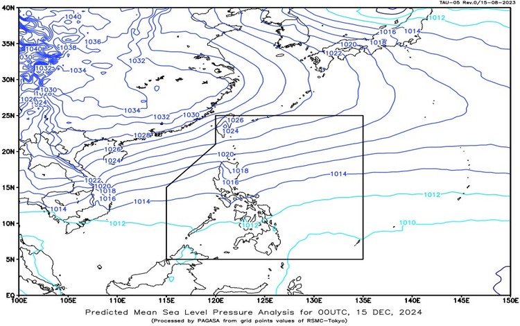
The shear line continues to affect the eastern section of Southern Luzon, while the northeast monsoon influences the rest of Luzon. These weather systems are expected to bring varying conditions across the country.
Forecast Weather Conditions
Bicol Region and Northern Samar
- Weather: Cloudy skies with scattered rains and isolated thunderstorms.
- Cause: Shear line.
- Impacts: Possible flash floods or landslides due to moderate to heavy rains.
Cagayan Valley, Cordillera Administrative Region, Aurora, and Quezon
- Weather: Cloudy skies with rain.
- Cause: Northeast monsoon.
- Impacts: Possible flash floods or landslides due to moderate to heavy rains.
Metro Manila and the Rest of Luzon
- Weather: Partly cloudy to cloudy skies with isolated light rains.
- Cause: Northeast monsoon.
- Impacts: No significant impact.
Rest of the Country
- Weather: Partly cloudy to cloudy skies with isolated rain showers or thunderstorms.
- Cause: Easterlies.
- Impacts: Possible flash floods or landslides during severe thunderstorms.
Forecast Wind and Coastal Water Conditions
Northern and Central Luzon
- Wind Speed: Strong to gale.
- Wind Direction: Northeast.
- Coastal Waters: Rough to very rough (2.8 to 4.5 meters).
Rest of Luzon and Eastern Visayas
- Wind Speed: Moderate to strong.
- Wind Direction: Northeast.
- Coastal Waters: Moderate to strong (1.5 to 3.4 meters).
Rest of the Country
- Wind Speed: Light to moderate.
- Wind Direction: Northeast to north.
- Coastal Waters: Slight to moderate (0.6 to 2.5 meters).
Monitoring Potential Weather Disturbances
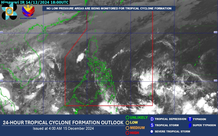
PAGASA closely monitors a cloud cluster outside the Philippine Area of Responsibility (PAR) that may develop into a low-pressure area (LPA). According to weather specialist Ana Clauren-Jorda, this system has a moderate chance of intensifying into a tropical cyclone in the coming days.
“Currently, no low-pressure area or storm is being monitored that could directly affect the country, but we are tracking a cloud cluster outside our area of responsibility,” said Clauren-Jorda. “Based on our projection, this may develop into an LPA in the next few days.”
Impacts of Current Weather Systems
The shear line, which results from the convergence of warm and cold winds, brings cloudy skies with light to moderate rains over parts of Quezon and the Bicol Region. Meanwhile, the northeast monsoon is expected to sustain light to moderate rains across Cagayan Valley, Aurora, and the Cordillera Administrative Region. These conditions pose risks of localized flooding and landslides, particularly in areas with significant rainfall.

Residents in affected regions are advised to stay updated through official PAGASA bulletins and take necessary precautions, especially in low-lying and flood-prone areas. Mariners are also cautioned about rough sea conditions in Northern and Central Luzon.
For further information and updates, the public is encouraged to monitor announcements from PAGASA.
