As of October 9, 2024, the Philippine Atmospheric, Geophysical, and Astronomical Services Administration (Pagasa) issued its weather forecast, highlighting the effects of the Northeasterly Surface Windflow on extreme Northern Luzon. This windflow is expected to influence the weather in Batanes and the Babuyan Islands.
Tropical Depression Update
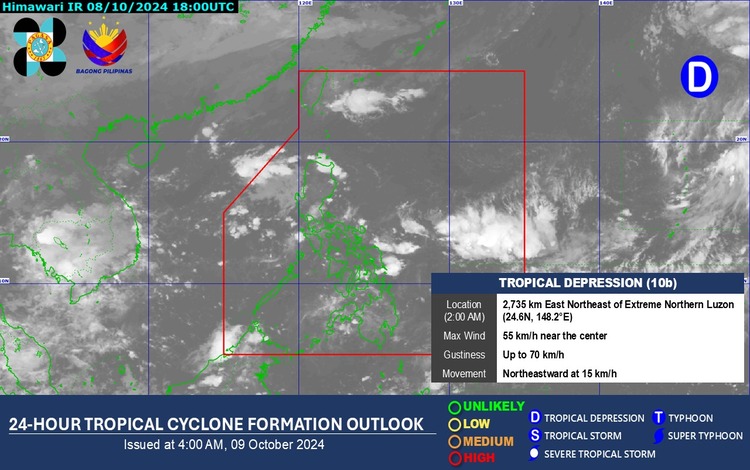
As of 3:00 AM today, a Tropical Depression is located 2,755 km east-northeast of extreme Northern Luzon, outside the Philippine Area of Responsibility (PAR). The depression is currently at coordinates 24.8°N, 148.4°E, with maximum sustained winds of 55 km/h near the center and gustiness reaching up to 70 km/h. It is moving northeastward at a speed of 15 km/h. Despite its proximity, Pagasa reports that this tropical depression remains unlikely to enter the PAR.
Dissipation of Low-Pressure Area
The Low-Pressure Area (LPA 10a) being monitored within the Philippine Area of Responsibility has dissipated as of 2:00 AM today. No further impact is expected from this system.
Weather Conditions
Batanes and the Babuyan Islands can expect partly cloudy to cloudy skies with isolated light rains caused by the Northeasterly Surface Windflow. No significant weather impacts are anticipated in these areas.
In Metro Manila and the rest of the country, residents can expect partly cloudy to cloudy skies with isolated rain showers or thunderstorms due to localized thunderstorms. While these weather conditions are typical, Pagasa warns of the potential for flash floods or landslides, especially during severe thunderstorms.
Wind and Coastal Water Conditions
In Northern Luzon, the wind will blow from the northeast at light to moderate speeds. Coastal waters in the region are expected to have slight to mild conditions, with wave heights ranging from 0.6 to 2.5 meters.
For the eastern sections of Central and Southern Luzon, light to moderate winds will come from the northeast to northwest, resulting in slight to moderate coastal waters with waves between 0.6 and 2.5 meters.
In the rest of the country, wind speeds will be light to moderate, coming from the south to the southwest. Coastal waters will remain slightly moderate, with wave heights of 0.6 to 2.1 meters.