SYNOPSIS:
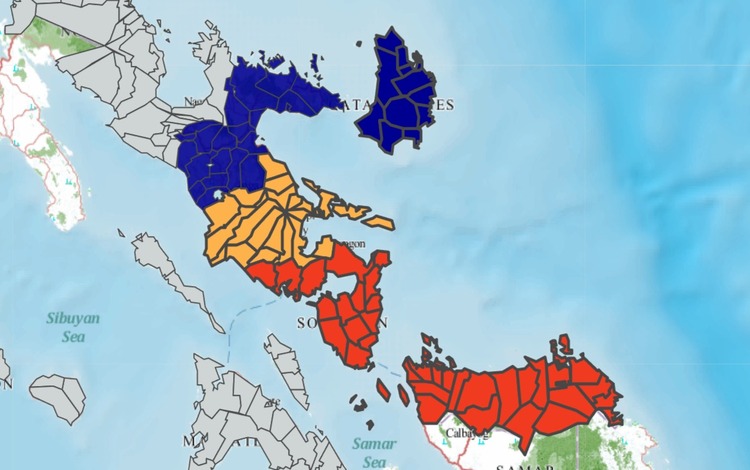
The Shear Line affects the eastern sections of Southern Luzon and Visayas, while the Northeast Monsoon impacts Northern and Central Luzon.
Weather Conditions and Impacts
Visayas, Bicol Region, MIMAROPA, and Quezon:
- Weather Condition: Cloudy skies with scattered rains and isolated thunderstorms.
- Caused By: Shear Line.
- Impacts: Moderate to heavy rains may lead to flash floods or landslides, particularly in low-lying and mountainous areas.
Caraga and Davao Region:
- Weather Condition: Cloudy skies with scattered rains and thunderstorms.
- Caused By: Intertropical Convergence Zone (ITCZ).
- Impacts: Flash floods or landslides are possible due to moderate to heavy rainfall.
Cagayan Valley, Cordillera Administrative Region, and Central Luzon:
- Weather Condition: Cloudy skies with rain.
- Caused By: Northeast Monsoon.
- Impacts: Moderate to heavy rains may trigger flash floods or landslides.
Metro Manila and the Rest of Luzon:
- Weather Condition: Partly cloudy to cloudy skies with isolated light rains.
- Caused By: Northeast Monsoon.
- Impacts: No significant hazards are expected.
Rest of Mindanao:
- Weather Condition: Partly cloudy to cloudy skies with isolated rain showers or thunderstorms.
- Caused By: Localized thunderstorms.
- Impacts: Severe thunderstorms may cause flash floods or landslides.
Heavy Rainfall Outlook
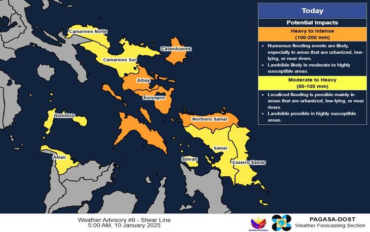
Today, January 10, 2025:
- Heavy to Intense (100-200 mm): Catanduanes, Albay, Masbate, Sorsogon, and Northern Samar.
- Moderate to Heavy (50-100 mm): Camarines Norte, Camarines Sur, Romblon, Eastern Samar, Aklan, Samar, and Biliran.
Tomorrow, January 11, 2025:
- Heavy to Intense (100-200 mm): Camarines Norte, Camarines Sur, Catanduanes, and Albay.
- Moderate to Heavy (50-100 mm): Quezon, Masbate, Sorsogon, and Northern Samar.
Sunday, January 12, 2025:
- Moderate to Heavy (50-100 mm): Quezon, Camarines Norte, Camarines Sur, Catanduanes, Albay, and Sorsogon.
Forecast rainfall may be higher in elevated areas. Antecedent rainfall could worsen impacts in vulnerable locations.
Flood and Coastal Water Warnings
- Northern Luzon: Strong to gale winds with rough to very rough coastal waters (2.8-4.5 meters).
- Eastern Sections of Luzon and Visayas: Moderate to strong winds with moderate to rough coastal waters (2.5-3.5 meters).
- Rest of the Country: Light to moderate winds with slight to moderate coastal waters (0.6-2.5 meters).
Heavy Rainfall Warning
- Orange Warning: Masbate (including Ticao and Burias Islands), with flooding threats and landslides.
- Yellow Warning: Catanduanes, indicating possible flooding and landslides in low-lying and near river channels.
- Red Warning: Northern Samar and Sorsogon, with severe flooding and higher landslide risks.