SYNOPSIS: The Northeast Monsoon is currently affecting Extreme Northern Luzon, while the Shear Line influences Central Luzon and the rest of Northern Luzon.

Forecast Weather Conditions
- Batanes
- Weather Condition: Cloudy skies with rains
- Cause: Northeast Monsoon
- Impacts: Possible flash floods or landslides due to moderate to heavy rains
- Central Luzon, Ilocos Region, Cordillera Administrative Region, and the rest of Cagayan Valley
- Weather Condition: Cloudy skies with scattered rainshowers and isolated thunderstorms
- Cause: Shear Line
- Impacts: Possible flash floods or landslides due to moderate to heavy rains
- Metro Manila and the rest of the country
- Weather Condition: Partly cloudy to cloudy skies with isolated rainshowers or thunderstorms
- Cause: Localized Thunderstorms
- Impacts: Possible flash floods or landslides during severe thunderstorms
Forecast Wind and Coastal Water Conditions
- Extreme Northern Luzon
- Wind Speed: Strong to Gale
- Direction: Northeast
- Coastal Waters: Rough to Very Rough (2.8 to 4.5 meters)
- The rest of Northern Luzon and eastern section of Central Luzon
- Wind Speed: Moderate to Strong
- Direction: Northeast
- Coastal Waters: Moderate to Rough (2.5 to 4.5 meters)
- The rest of the country
- Wind Speed: Light to Moderate
- Direction: East to Northeast
- Coastal Waters: Slight to Moderate (0.6 to 2.5 meters)
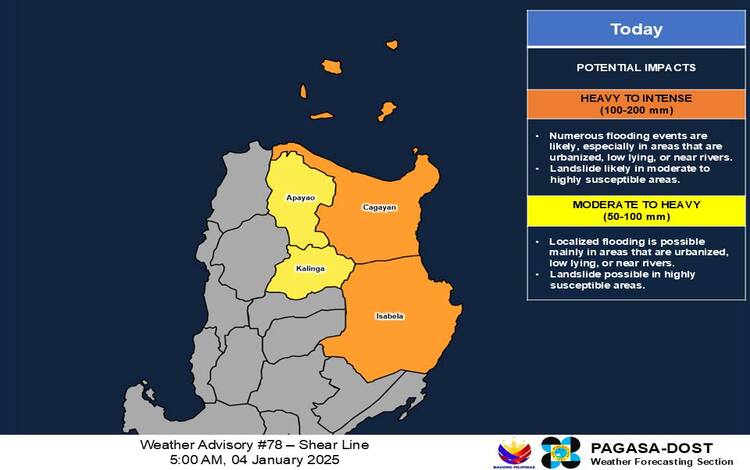
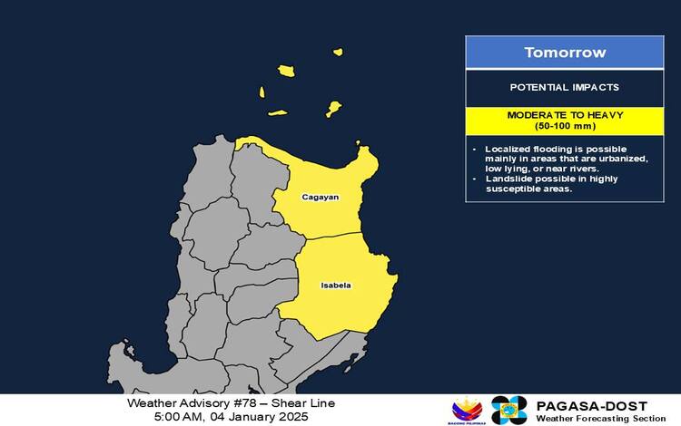
Heavy Rainfall Outlook
- Today:
- Heavy to Intense (100-200 mm): Cagayan and Isabela
- Moderate to Heavy (50-100 mm): Apayao and Kalinga
- Tomorrow:
- Moderate to Heavy (50-100 mm): Cagayan and Isabela

Rainfall is expected to be higher in mountainous and elevated areas. Impacts may worsen in areas with significant antecedent rainfall.
General Flood Advisories
As of 6:00 AM, January 4, 2025:
- CAR (Cordillera Administrative Region): GFA #3
- Region 2 (Cagayan Valley): GFA #7
- Region 3 (Central Luzon): GFA #6
- Region 4A (CALABARZON): GFA #6
- Region 4B (MIMAROPA): GFA #28 (Final)
- Region 5 (Bicol Region): GFA #8 (Final)
