The Philippine Atmospheric, Geophysical, and Astronomical Services Administration (Pagasa) has issued its weather forecast for today, October 14, 2024, highlighting the influence of the shear line and easterlies on various parts of the country. The forecast warns of potential impacts from thunderstorms and scattered rains, with particular concern for flash floods and landslides in certain areas.
Weather Synopsis
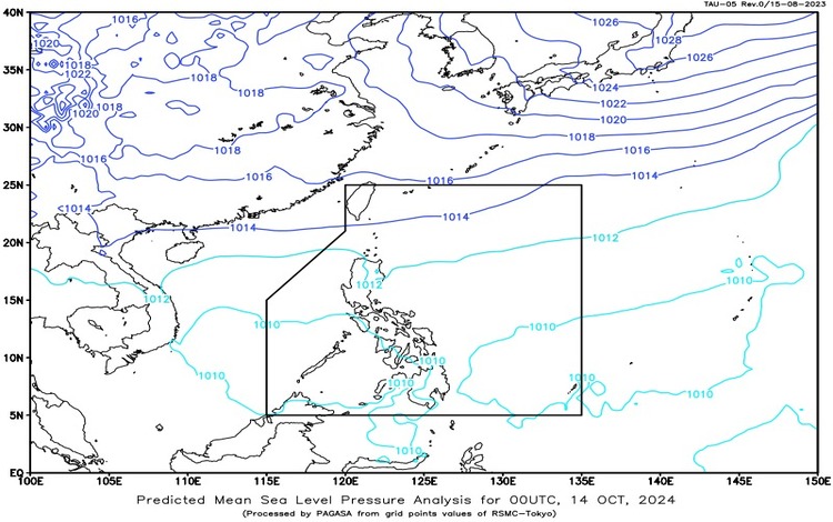
- Shear Line: The shear line is affecting Extreme Northern Luzon, particularly Batanes.
- Easterlies: Easterlies are affecting the eastern sections of Luzon and the Visayas, bringing warmer winds from the Pacific Ocean.
Forecast Weather Conditions
- Batanes
- Weather Condition: Cloudy skies with scattered rains and thunderstorms.
- Caused by: Shear Line.
- Impacts: The shear line could bring moderate to at times heavy rains, which may cause flash floods or landslides, particularly in low-lying or mountainous areas.
- Cagayan, Isabela, Aurora, and Quezon
- Weather Condition: These provinces will experience cloudy skies with scattered rains and thunderstorms.
- Caused by: Easterlies.
- Impacts: Similar to Batanes, these areas may face potential flash floods or landslides due to moderate to heavy rains.
- Metro Manila, the rest of Luzon, and Eastern Visayas
- Weather Condition: Partly cloudy to cloudy skies with isolated rain showers or thunderstorms.
- Caused by: Easterlies.
- Impacts: Although rains are expected to be less widespread, there is still a possibility of flash floods or landslides during severe thunderstorms.
- The Rest of the Country
- Weather Condition: Areas outside of the aforementioned regions will have partly cloudy to cloudy skies with isolated rain showers or thunderstorms.
- Caused by: Localized thunderstorms.
- Impacts: Like other areas, these thunderstorms could lead to flash floods or landslides during intense rainfall.
Forecast Wind and Coastal Water Conditions
- Luzon and Visayas
- Wind Speed: Light to moderate.
- Wind Direction: Northeast to East.
- Coastal Waters: Seas are expected to be slight to moderate, with wave heights between 0.6 and 2.5 meters.
- Mindanao
- Wind Speed: Light to moderate.
- Wind Direction: East.
- Coastal Waters: Slight to moderate seas with wave heights ranging from 0.6 to 2.1 meters.
Specific Area Forecasts
- Eastern Visayas
- Weather Condition: Partly cloudy to cloudy skies with isolated rain showers and thunderstorms.
- Caused by: Easterlies.
- Impacts: Similar to other areas affected by the easterlies, flash floods and landslides are possible during severe thunderstorms.
- The Rest of Visayas, Occidental Mindoro, and Palawan (including Kalayaan Islands)
- Weather Condition: These areas will experience partly cloudy to cloudy skies with isolated rain showers and thunderstorms.
- Caused by: Localized thunderstorms.
- Impacts: Flash floods or landslides are possible in areas affected by heavy downpours during thunderstorms.
- Wind Conditions: Light to moderate winds from the northeast to east will blow throughout the Visayas, Occidental Mindoro, and Palawan, including the Kalayaan Islands. Coastal waters are expected to remain slight to moderate.
Advisories
Pagasa monitors the weather systems closely and advises residents in affected areas, particularly in Batanes, Cagayan, Isabela, Aurora, and Quezon, to remain vigilant for possible flash floods or landslides. Motorists and those in low-lying areas are advised to take precautions during thunderstorms, especially in areas prone to flooding. Those living in mountainous regions should be cautious of potential landslides, particularly after long periods of rainfall.