As of 5:00 PM on October 3, 2024, the Philippine Atmospheric, Geophysical, and Astronomical Services Administration (PAGASA) issued its latest update on Typhoon Julian (international name: KRATHON), which made landfall in southern Taiwan. While the typhoon remains outside the Philippine Area of Responsibility (PAR), its proximity to the northernmost regions of the country continues to warrant close monitoring.
Current Location and Intensity
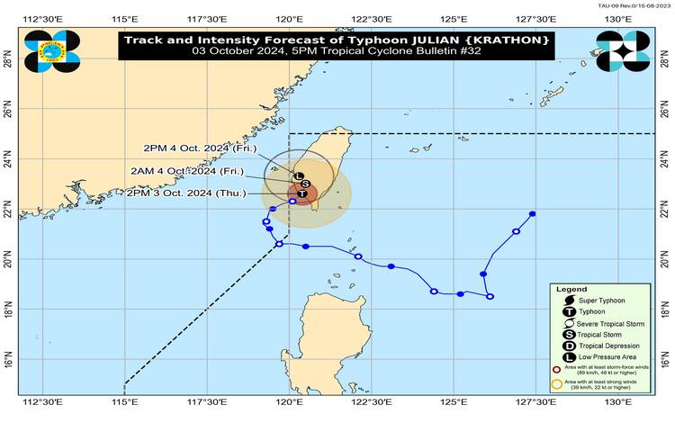
At 4:00 PM, the eye of Typhoon Julian was located approximately 255 km north-northwest of Itbayat, Batanes, at coordinates 22.7°N, 120.5°E. The typhoon is currently packing maximum sustained winds of 120 km/h near its center, with gusts reaching up to 165 km/h. The central pressure of the storm is at 975 hPa.
Typhoon Julian is moving east-northeastward at a relatively slow pace of 10 km/h. Despite its re-entry into the PAR region, no wind signals are currently hoisted for any part of the Philippines.
Impact on Coastal Waters
While no wind signals have been issued, the typhoon’s presence has resulted in potentially hazardous sea conditions. According to PAGASA, moderate to rough seas can be expected over several coastal areas within the next 24 hours:
- Up to 4.0 meters over the seaboards of Batanes, Babuyan Islands, and Ilocos Norte
- Up to 3.5 meters over the remaining seaboards of the Ilocos Region
- Up to 3.0 meters over the northern seaboard of mainland Cagayan, Zambales, and Bataan
- Up to 2.5 meters over the western seaboard of Lubang Island, the western seaboard of the Calamian Islands, and the seaboard of the Kalayaan Islands
Mariners operating small seacrafts and motorbancas are advised against venturing out to sea, especially if inexperienced or using ill-equipped vessels.
Forecast and Outlook
Typhoon Julian is expected to weaken further due to several factors. The approaching northeasterly wind flow over the East China Sea and Taiwan Strait, combined with the lower ocean heat content caused by the typhoon’s slow movement over the last three days, is contributing to its decline in strength. Moreover, its interaction with Taiwan’s rugged terrain will accelerate this weakening process.
PAGASA forecasts that Typhoon Julian will eventually become a remnant low over Taiwan by tomorrow, October 4. Despite its movement and re-entry into the PAR, no direct impact on the Philippines is anticipated at this time.
Authorities advise the public to remain vigilant for any further developments, particularly those in northern Luzon, where weather conditions may still be indirectly affected by the typhoon’s presence in nearby Taiwan.