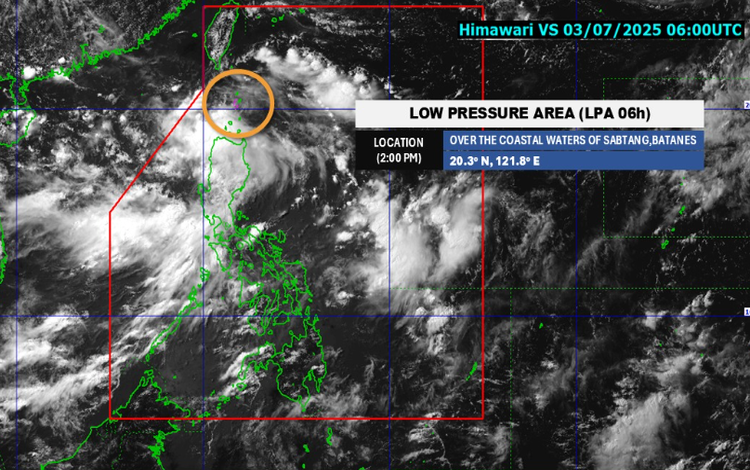
The Philippine Atmospheric, Geophysical and Astronomical Services Administration (PAGASA) has issued a weather advisory at 5:00 p.m. on July 3, 2025, warning of heavy rainfall caused by a Low Pressure Area (LPA) and the prevailing Southwest Monsoon (Habagat). The LPA, located off the coastal waters of Sabtang, Batanes, has a medium chance of developing into a tropical depression within the next 24 hours.
Heavy Rainfall Outlook
From today until tomorrow afternoon (July 4), 100–200 mm of rainfall is expected in Ilocos Norte, Pangasinan, Zambales, and Bataan. Meanwhile, 50–100 mm of rain is expected to affect Metro Manila, Batanes, Cagayan, the Cordillera provinces, Central Luzon, CALABARZON, and Occidental Mindoro. The rain may be more intense in mountainous areas.
From tomorrow afternoon to Saturday (July 5), similar rainfall levels are forecast across Northern and Central Luzon, particularly in Batanes, Cagayan, Ilocos Region, Abra, Benguet, Zambales, and Bataan.
By Saturday afternoon through Sunday (July 6), Batanes may again receive 100–200 mm of rain, while Ilocos provinces and La Union could receive 50–100 mm.
Forecast Weather Conditions
- Ilocos Norte, Apayao, Kalinga, Abra, Batanes, and Cagayan will experience cloudy skies with scattered rains and thunderstorms brought by the LPA. Flash floods and landslides are possible due to moderate to heavy rainfall.
- Metro Manila, Central Luzon, CALABARZON, Occidental Mindoro, and parts of Cagayan Valley and CAR will see occasional rains from the Southwest Monsoon, also bringing the risk of flash floods and landslides.
- Western Visayas and the rest of Luzon can expect scattered rain showers and thunderstorms due to the same monsoon system.
Public Advisory
PAGASA urges the public and local disaster risk reduction and management councils to stay alert. Localized Heavy Rainfall Warnings, Thunderstorm Advisories, and other critical weather updates may be issued by PAGASA’s regional services.
It is essential to note that Heavy Rainfall Warnings differ from general Weather Advisories—the former is more immediate, specific, and accurate for short-term flood threats, particularly using Doppler radar.