The Philippine Atmospheric, Geophysical and Astronomical Services Administration (PAGASA) announced early Friday, July 4, that the Low Pressure Area west of Calayan, Cagayan has developed into Tropical Depression BISING. The system is currently affecting parts of Northern Luzon with strong winds and rough seas.
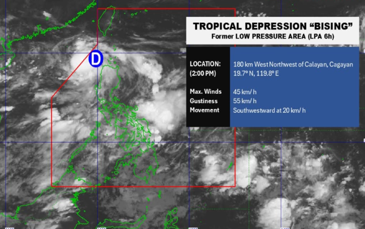
As of 4:00 AM today, the center of Tropical Depression BISING was located approximately 200 kilometers west-northwest of Calayan, Cagayan (19.7°N, 119.6°E). It carries maximum sustained winds of 45 km/h, gusts up to 55 km/h, and a central pressure of 1002 hPa. BISING is moving southwestward at 20 km/h.
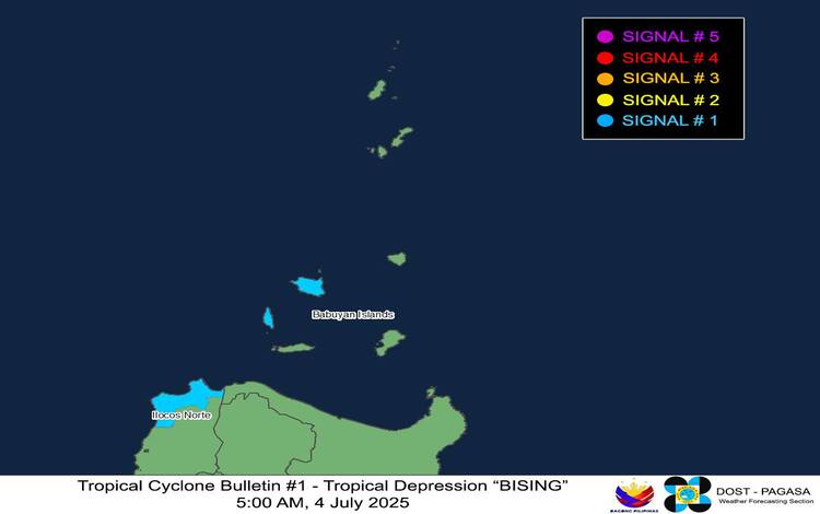
Signal No. 1 Raised in Northern Luzon
Tropical Cyclone Wind Signal No. 1 is in effect over the western portion of the Babuyan Islands (Calayan and Dalupiri Islands) and the northwestern part of Ilocos Norte, including Pagudpud, Bangui, Burgos, Pasuquin, and Dumalneg. Residents in these areas are advised to expect minimal to minor impacts from strong winds over the next 36 hours.
Rainfall and Wind Hazards
While no heavy rainfall warning has been issued with this bulletin, PAGASA refers the public to Weather Advisory No. 9 issued earlier for rainfall outlooks related to both BISING and the enhanced Southwest Monsoon. Coastal and upland areas may experience locally stronger winds.
Rough Seas Warning for Small Boats
Rough sea conditions up to 3.0 meters are expected along the western seaboards of the Babuyan Islands. Moderate to rough seas of up to 2.5 meters are forecast along the western coast of Ilocos Norte and parts of Ilocos Sur. Mariners of small vessels, particularly motorbancas, are strongly advised against setting out to sea.
Forecast Track and Intensity
BISING is forecast to continue on a westward track and may exit the Philippine Area of Responsibility (PAR) within the day. However, a turn northeastward and possible re-entry into PAR by Sunday, July 6, is possible. It is also expected to strengthen into a tropical storm by Saturday evening, with further intensification likely as it heads toward the sea south of Taiwan.